
The Dunedin Town Belt plays a special part in the history and operations of the Dunedin Amenities Society and for over 136 years the Society has advocated for its protection, preservation and enhancement as a unique asset for the Dunedin community and environment. When city authorities began planning Queen Victoria’s Jubilee in 1888 it was Society co-founder Thomas Brown who sought the beautification and development of Jubilee Park, then known as Tomlinson’s Paddock. As an advocate and voice for the Town Belt the Society has come to recognise that the reserve is not simply an important recreational and ecological corridor, but is actually an important part of Dunedin’s heritage and history.
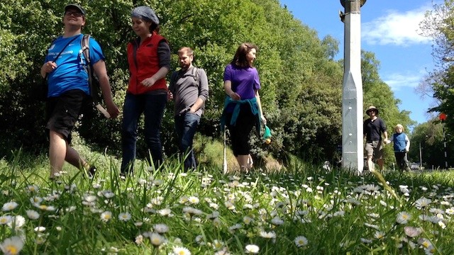
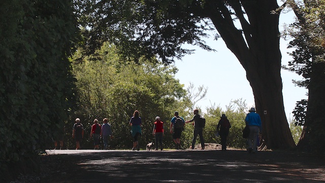
In 2013 the Society celebrated its 125th anniversary and undertook a free public walking event called the “Town Belt Traverse” as a way of sharing the reserve celebrating with the Dunedin community. With over 500 participants from all walks of life and ages that event strengthened the Society’s belief that a permanent interpretative trail was needed to tell the story and values of the Belt. Importantly too, the Society wants to breath new life into the reserve and create new generations of people enthusiastic for the area, so that the reserve will not just ring with bird life but with people enjoying what the Town Belt has to offer. The Town Belt Traverse also links other historical and heritage areas of Dunedin and those links can be developed to give a wider understanding of the nature of our city.
The Traverse Map
The interactive map gives people the opportunity to visit areas along the Traverse trail that was used in 2013 and would be the basis for the permanent trail in the future. This is also an opportunity for people to learn more about the reserve’s early beginnings and some of the historical significance to the city of the Town Belt. The Society has added the “Toitu Gold” trail from Queens Gardens to Maori Road where you can follow the course of the stream Toitu and follow the route miners would have used to the temporary mining camp at Tomlinson’s Paddock on their way to the Central Otago goldfields. The third trail explores a portion of the Botanic Gardens links the historic Northern Cemetery, Bracken’s View and Lovelock Avenue.
Navigating the Map
The map is embedded from Google Maps and is open for use by the public as a recreational, historic and biodiversity resource by those who wish to explore the Town Belt and learn more about the area. You can navigate using the controls within the page to make the map bigger and smaller or select “view larger map” to see the map in a full screen size.
- Be prepared and wear sensible footwear and clothing.
- Be careful around the roads and use the pedestrian crossings on the traverse.
- Be visible by wearing reflective clothing and always carry a light at night.
- Tell someone where you’re going, the Town Belt is a big place (202 hectares)
- Keep your dog on a lead, carry a ‘doggie’ bag for toileting. The Botanic Garden and all cemeteries are dog-free areas.
- Take your rubbish home with you and pick up any litter that annoys you! (Thank you!)
- Explore with a friend or your family and enjoy it even more!
The Dunedin Amenities Society acknowledges the Dunedin City Council, Toitu Otago Settlers’ Museum, Hocken Library, Te Papa Collections and Albert Green for their contributions of information for this map.
The following images are historical notes of key points along the route (these were presented as information boards posted for the benefit of the traverse participants)
(Double left click on any image to open for improved legibility)


Leave a comment